Why a Bay Can Make the Shore Feel Near and Far at Once
A bay makes the shore feel near and far at once. Learn to read its curves, sightlines and crossings so a coastal route makes more sense.
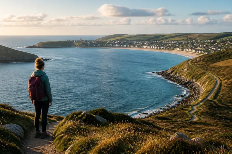
A bay can make the shore feel near and far at once because the eye measures open water while the feet follow a curve. From one headland, a town on the opposite side may look close enough to call to; reaching it by land can mean a long turn around the water. The mismatch is not a navigational error. It is the bay doing what bays do.
That difference becomes useful when you are choosing a route, judging a crossing or trying to understand why a coastal map seems to disagree with the view. The first fix is to stop treating visible distance, walking distance and travel time as interchangeable. They rarely are around a curved shoreline.
Why does the opposite shore look so close?
Water leaves the view unobstructed. Across a bay, your gaze can travel directly to a strip of land, a cluster of roofs or a pale line of beach. There are few visible clues to the ground between you and that destination, so the mind tends to treat the straight sightline as the route.
But a sightline is not a path. A headland may block the land route, a steep slope may keep a road away from the water, or the shore itself may bend before it reaches the place you can see. The bay hides these detours in plain sight: its water makes the view feel open while its outline lengthens the journey.
Try naming what you are measuring. If you mean “how far across the water does it look?”, the view can answer approximately. If you mean “how far will I travel on foot?”, you need a map with paths and roads. For “how long will it take?”, account for the route’s surface, elevation and access points as well. One glance cannot supply all three answers, however confident it feels.
Why does the walk keep getting longer?
The usual cause is following the inner curve of the bay. A route that hugs the water may seem like the direct choice because it keeps the shoreline in view. Yet the arc between two places is longer than the straight line across the bay, and the walk may include additional bends where creeks, cliffs, private land or seawalls interrupt the edge.
Maps can make this harder to notice. At a small scale, a bay’s curve is compressed and local obstacles disappear. A path shown near the shore may also sit on a shelf above the beach, end at a gate or connect to a road rather than continue as a waterside walk. The blue shape gives a clear impression; the thin route line may be less forthcoming.
Check the route at a closer scale before setting out. Look for the actual path alignment, road connections and places where the coast turns sharply. Satellite imagery can help show the shape of a headland or inlet, while a local trail map may clarify whether a marked line is public and continuous. For access questions, follow the signs on site rather than assuming that a line on a screen grants passage.
What should you try before committing to the route?
Use the map to compare the route you can walk with the crossing the view suggests. Note where the two shores approach one another, then identify whether a bridge, ferry or road actually connects them. A narrow-looking stretch of water is not automatically a crossing point. Bays are very good at making geography look cooperative.
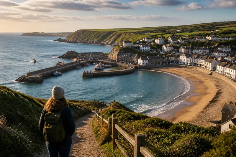
Say you are standing above a crescent-shaped bay and can see a village on the far side. Imagine that the map shows a road following the curve, with a footpath joining it only at the next headland. If you want to reach the village on foot, the expected result of checking that route first is a more realistic plan: you will know whether to follow the landward road, look for a marked crossing, or choose a shorter walk that ends at the viewpoint. The village has not moved; your route model has improved.
For a route decision, try this order:
- Mark your destination. Use the exact place, not a general label such as “the far shore.”
- Trace a continuous land route. Check for gaps, private access, roads without footpaths and abrupt changes in the shoreline.
- Look for a genuine crossing. Confirm that a bridge, ferry or other public connection exists and is operating when you need it.
- Compare the route with the terrain. Check for steep slopes, exposed sections and surfaces that may not suit your footwear or pace.
- Choose the journey you actually want. A longer walk along the curve can be the point; a direct crossing may be better when reaching the other side matters more.
Then keep a little flexibility. Coastal paths can be affected by closures, tides or weather, and a route that looks simple on a screen may feel different on the ground. Local signs, current transport information and your own comfort with the conditions are more useful than trying to make the map’s straight line come true.
How do landmarks distort your sense of distance?
A prominent landmark can make one side of a bay seem nearer than another. A church tower, bright hotel or breakwater gives the eye a precise target, while a low stretch of beach offers little detail. The clearer target often feels closer, even when it is not. Haze can reverse the effect by softening the far shore until it appears to retreat.
Use several landmarks rather than relying on one. Compare a building with a headland, beach access point or road junction, then check their positions on a map. If the features line up differently than expected, the coastline is likely turning out of view. This is especially helpful when a bay has smaller coves nested inside its main curve: the visible edge may not be the edge you would follow on foot.
Also notice whether you are looking across the bay or along it. Looking across gives a direct view to the opposing shore. Looking along the curve can hide distance behind successive headlands, making a nearby place seem farther away because part of the route is concealed. Neither view is false; each leaves out a different piece of the shape.
Why does a route feel different from its map?
A map presents distance as a line. A traveller experiences it as a sequence: a descent to the water, a path around a point, a stretch with the destination in sight, then perhaps another turn that removes it again. Repeatedly seeing the far shore can make progress seem slow, since the target stays visible while the route continues to bend.
Break the journey into recognizable sections instead of judging it against the destination’s apparent position. A beach entrance, bridge, headland or road junction gives you a nearer point to aim for. This does not shorten the route, but it makes the shape of the trip easier to read. If the path offers no useful landmarks, check your map at sensible stopping points rather than repeatedly trying to estimate progress by eye.
When choosing between a coastal arc and a direct transfer, think about what the journey is for. The arc may offer changing views and access to beaches; the crossing may simply connect two settlements. A bay is not asking you to admire the longest possible route. It is asking, quietly, whether you came to travel along its edge or to get across it.
What do travellers ask about bay distances?
Is the far shore always farther away on foot?
No. A bridge, ferry or road can make a crossing straightforward, while a winding shoreline can make a nearby point a long walk. Check the actual connection rather than inferring the route from the view.
Why does a bay look smaller from a high viewpoint?
From above, more of the curve is visible at once, so the shape reads as a compact enclosure. The extra sightlines can also reveal how much shoreline lies between the observer and a destination that looks close across the water.
Can a map show the distance across the water?
Many map apps provide a straight-line measurement, but that is not a walking route. Treat it as a way to compare points across the bay, then use mapped paths, roads and crossings to plan travel on land.
How can I tell whether a coastal path follows the beach?
Inspect the route at a detailed scale and look for signs, access points and changes in elevation. A path near the water may run above the beach or divert inland, so check the marked route rather than relying on its broad position.
The useful habit is simple: let the view tell you what is visible, and let the route map tell you how the land connects. For anyone trying to understand why a bay makes the shore feel near and far at once, that distinction turns a puzzling panorama into practical information. The opposite shore can remain in sight for most of the day; that is a feature of the view, not a promise about the walk.